No Ground Infrastructure
Unlike camera towers, Nomadic requires zero ground installations. Deploy anywhere there's a power line.
Protect critical infrastructure with redeployable, self-charging sensors. Turn your high-fire-threat districts into a proactive, monitored grid without outages or ground infrastructure.
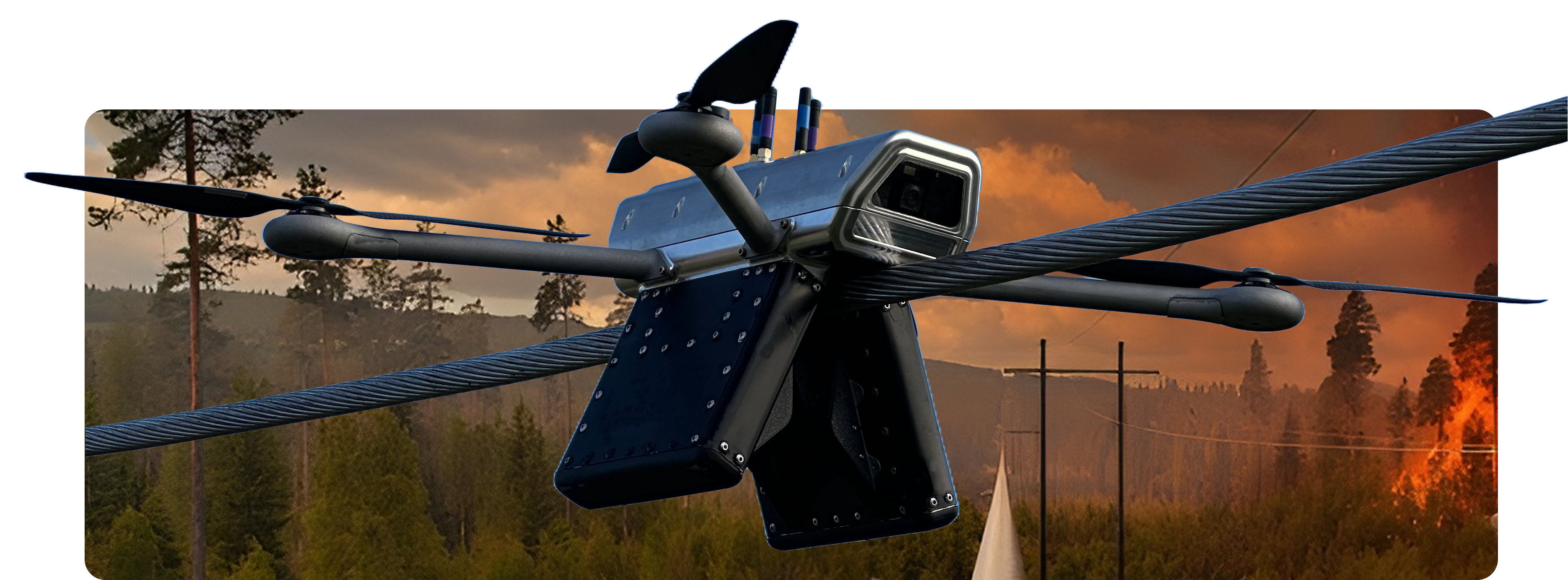
Our mobile units act as a first line of defense, providing visibility directly from the power line itself. Instead of being tied to a fixed pole, our sensors move as seasonal fire risks shift, eliminating the cost of permanent ground-based infrastructure.
Mounted directly on the line, our sensors use optical imagery and gas detection to identify smoke signatures in minutes. This allows control rooms to locate ignition instantly, enabling pre-emptive action before the fire becomes visible from the ground.
Unlike camera towers, Nomadic requires zero ground installations. Deploy anywhere there's a power line.
Multi-modal detection catches fires earlier than any single-sensor approach.
Drones reposition to cover high-risk zones during red flag weather events.
Cellular-connected with sub-minute alert latency to your control room.
Wildfires pose an existential threat to grid reliability, yet traditional detection methods are failing to keep up. Static cameras are blinded by terrain, satellite data lacks the speed for rapid response, and manual patrols are costly and reactive. You need to know exactly where a fire will start years in advance to place sensors effectively. It is an impossible task with fixed infrastructure.
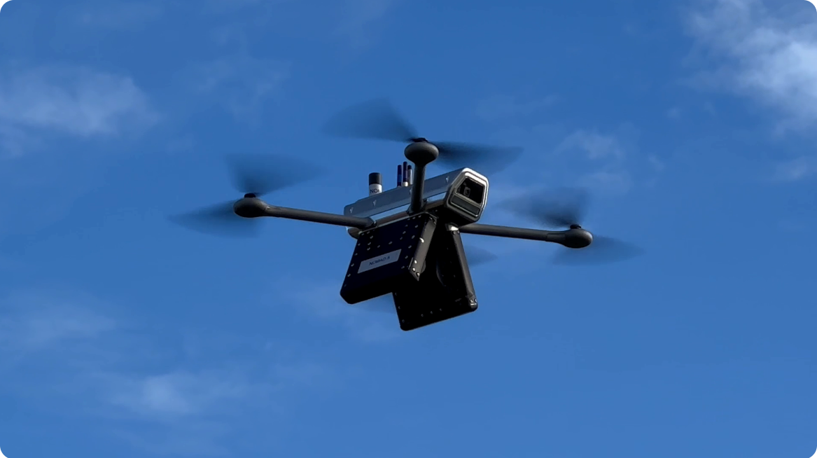
Nomadic develops a mobile, continuous monitoring system that requires no external power. Our drone lands on the conductor, locks in, and charges from the line’s field, providing a persistent "digital witness" that moves to where the risk is highest.
Pilot deploys drone on power line in 5 minutes by flying above power line
Drone sits on power line for extended time monitoring conditions
Teams are notified about potential ignition events, and can visually verify in platform
Response teams can be deployed quickly to mitigate situation before it escalates
The platform measures line temperature,sag, and line sway behavior at the source. This provides the data needed to predict andprevent "blow-out" events or vegetation contact before a spark occurs.
Using high-accuracy inertial measurementunits, we measure sag and clearance to high precision. This ensures that as you increase capacity, you never compromise safety margins or clearance regulations.
.png)
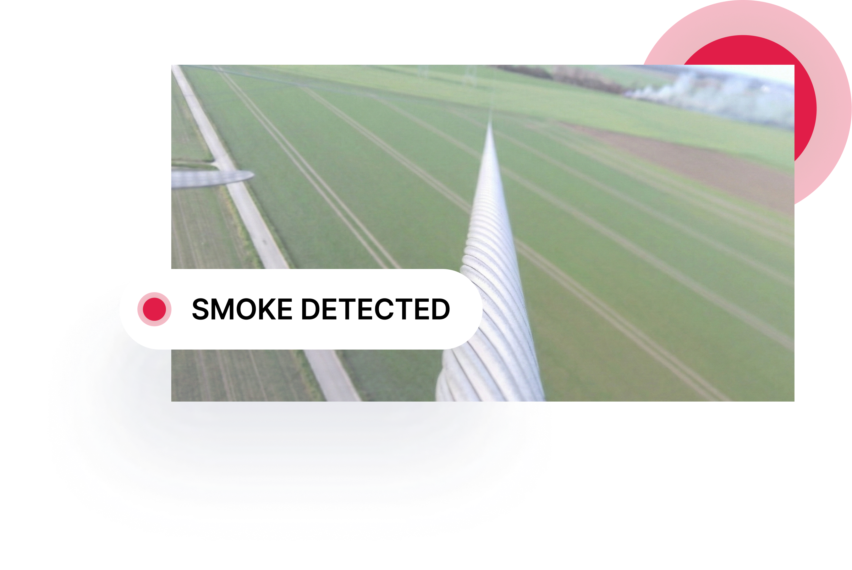
All data is transmitted via a secure mobile connection to the Nomadic Dashboard. When an ignition is detected, your team receives an instant alert with precise GPS coordinates and visual verification.